FT-mini is a newly launched survey-grade high-precision LiDAR sensor that can accurately acquire massive 3D point clouds in high-speed.
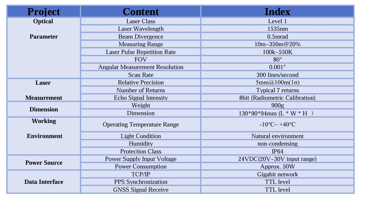
This lightweight airborne laser scanner has a FoV of 80 degree and a high pulse repetition rate up to 550KHz.With a scan speed of 300 lines/second, measuring range up to 350m and relative precision of 5mm@100m(1σ), FT-mini can performance quick and accurate 3D data collection for wide area coverage. The modular design, compact size and low weight of only 900g offers more integration options.
Specifications
Features
Survey-grade LiDAR Sensor
High accuracy, survey-grade LiDAR sensor.
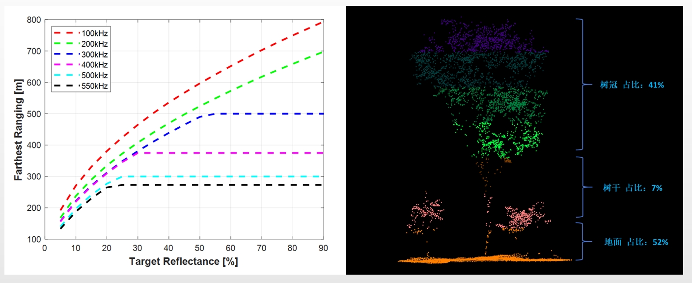
The measurement range reaches 350@20% reflectivity, better penetration capability based on typical 7 times returns, 5mm@100m(1σ) relative precision and laser PRR up to 550KHz
Survey-grade LiDAR Sensor
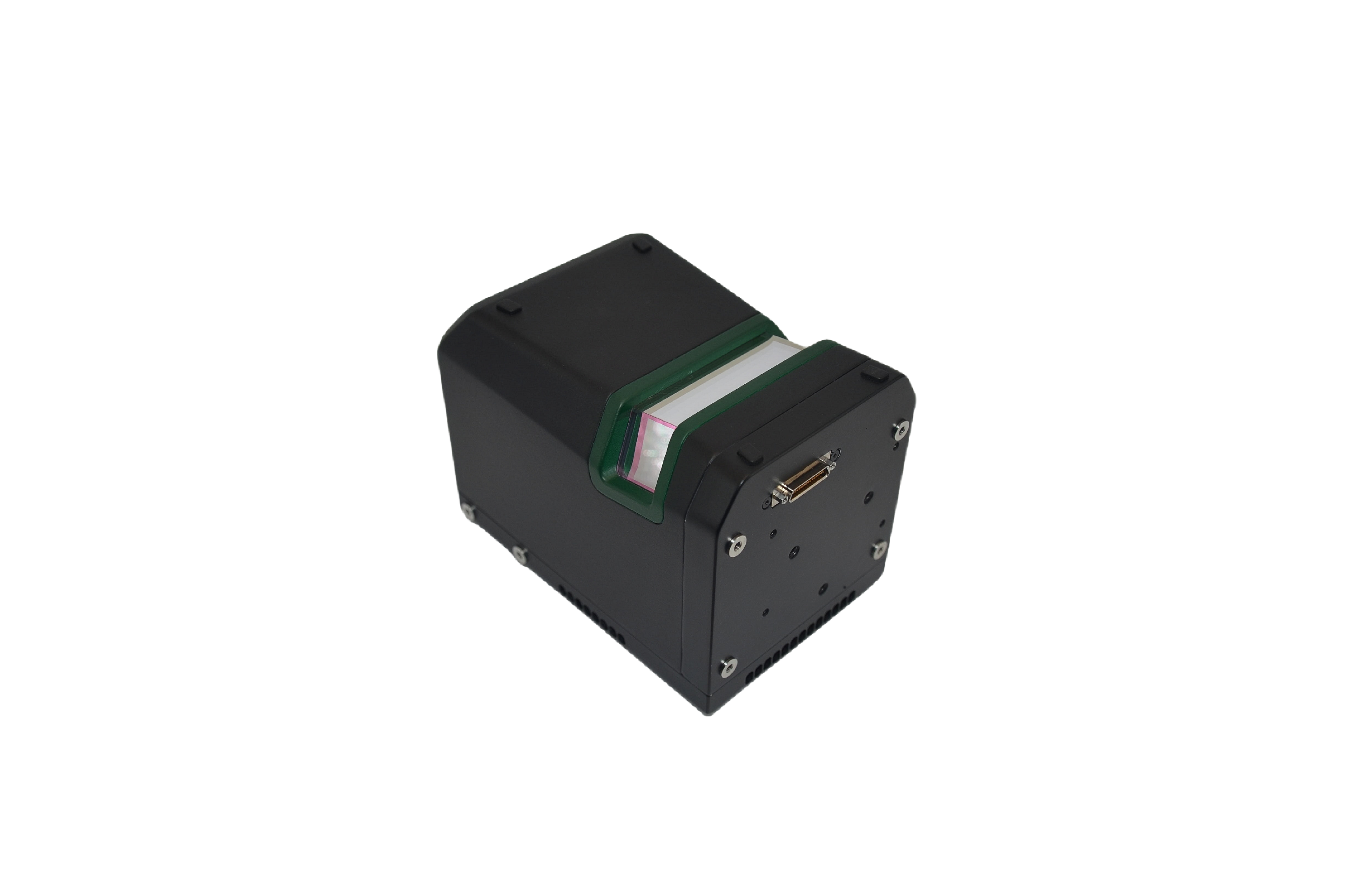
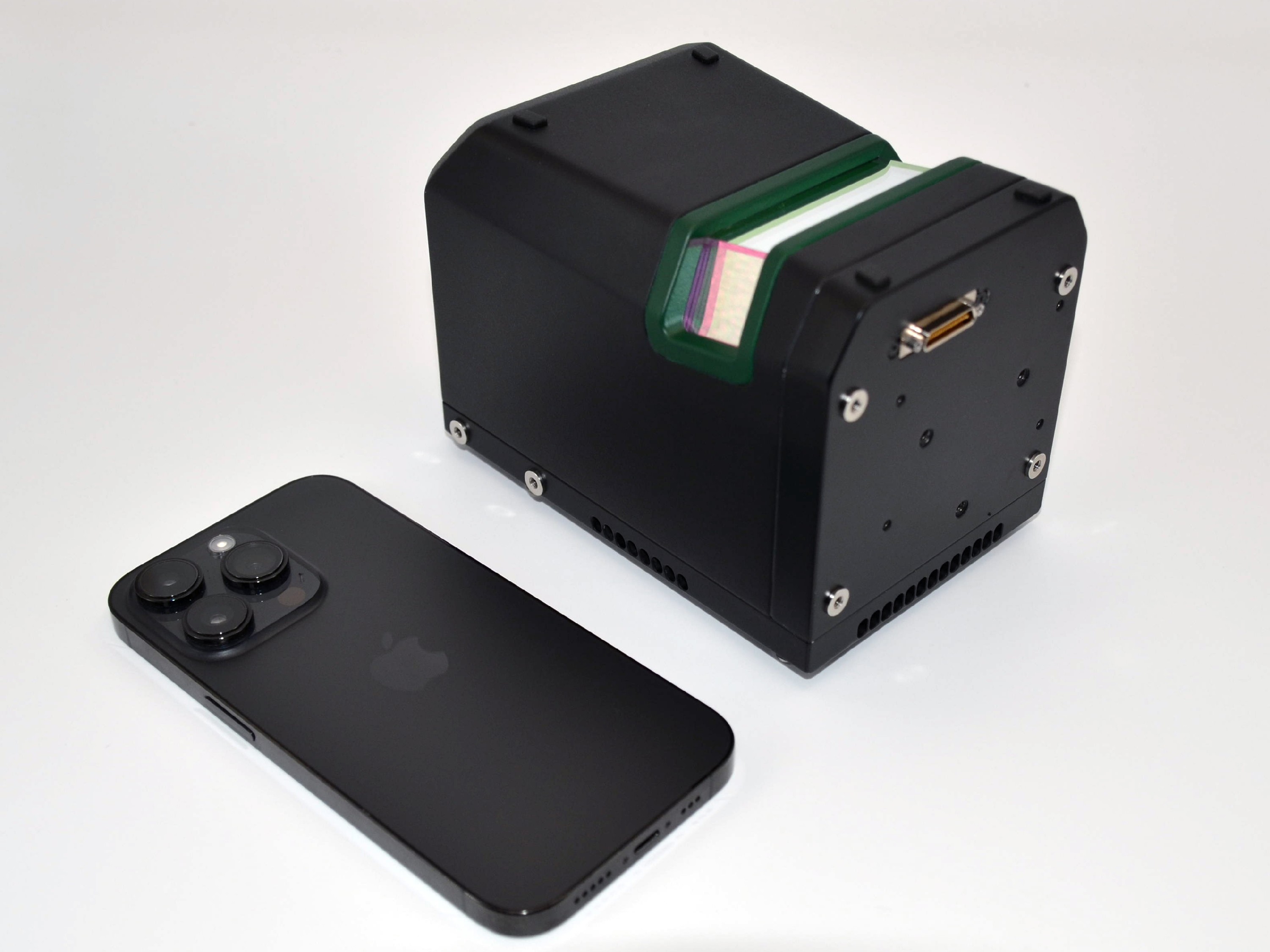
Ultra-lightweight and compact size.
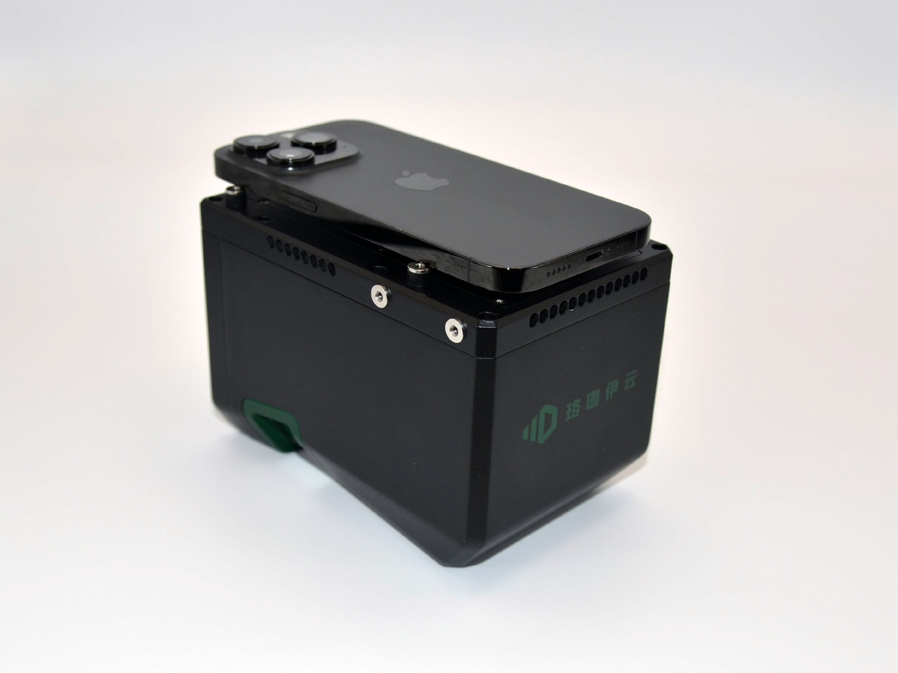
The sensor only weights 900g, and the dimension is 130*90*94mm(L*W*H), even shorter than an iPhone14 pro
Survey-grade LiDAR Sensor
High accuracy
Survey-grade LiDAR Sensor
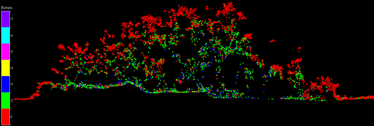
Multiple echos
-Survey-grade LiDAR Sensor
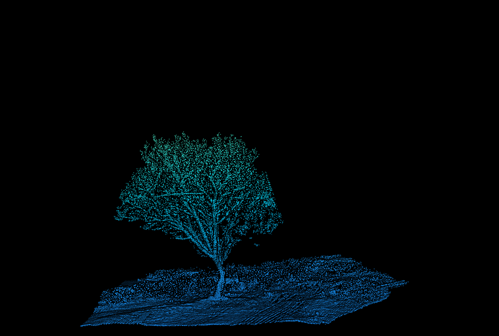
Small beam size for better penetration in vegetation

Survey-grade LiDAR Sensor
Modular design for flexible integration.
FT-mini adopts the modular design concept which means all the basic parts including optics, mechanical and electronical parts are independent from each other. This offers a possibility to provide flexible integration options based on this sensor. The main advantage is that the integrators can still use their own hardware architecture and POS/camera solution, still keep the solution as the original style.
1: Hardware interface: PPS/COM232/LAN/POWER
2: SDK ready to go: Network Port Control Protocol; SDK for converting raw data to scanning coordinate system
FT-mini
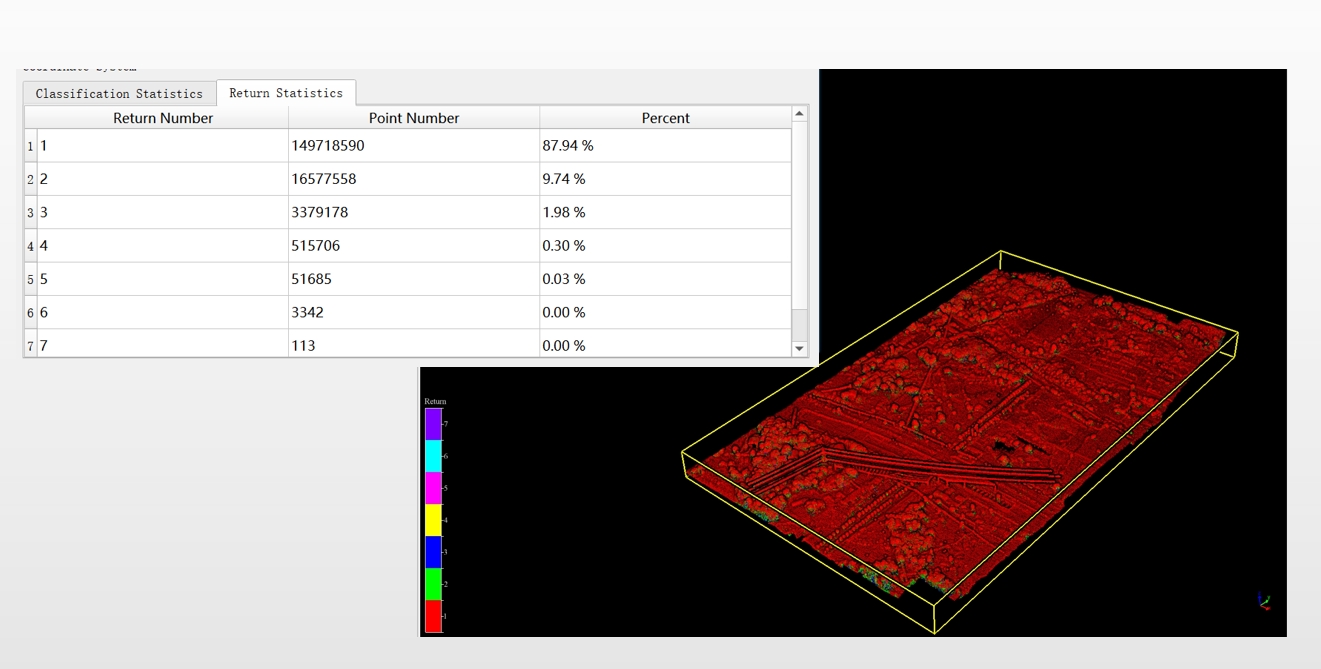
Data Result
FT-mini data review in detail
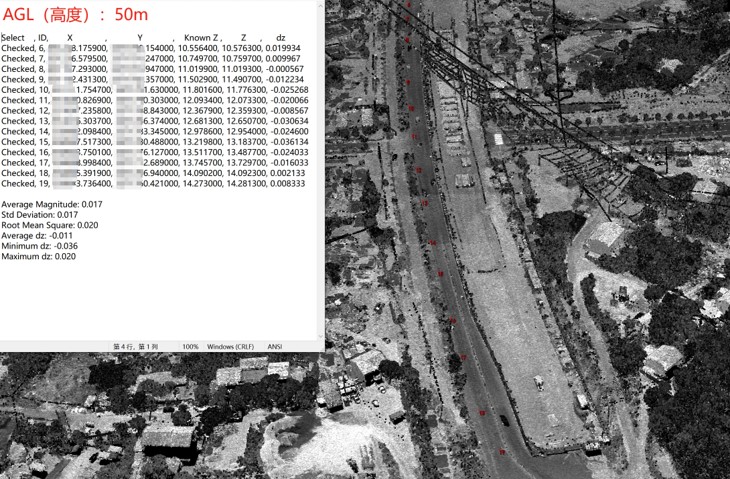
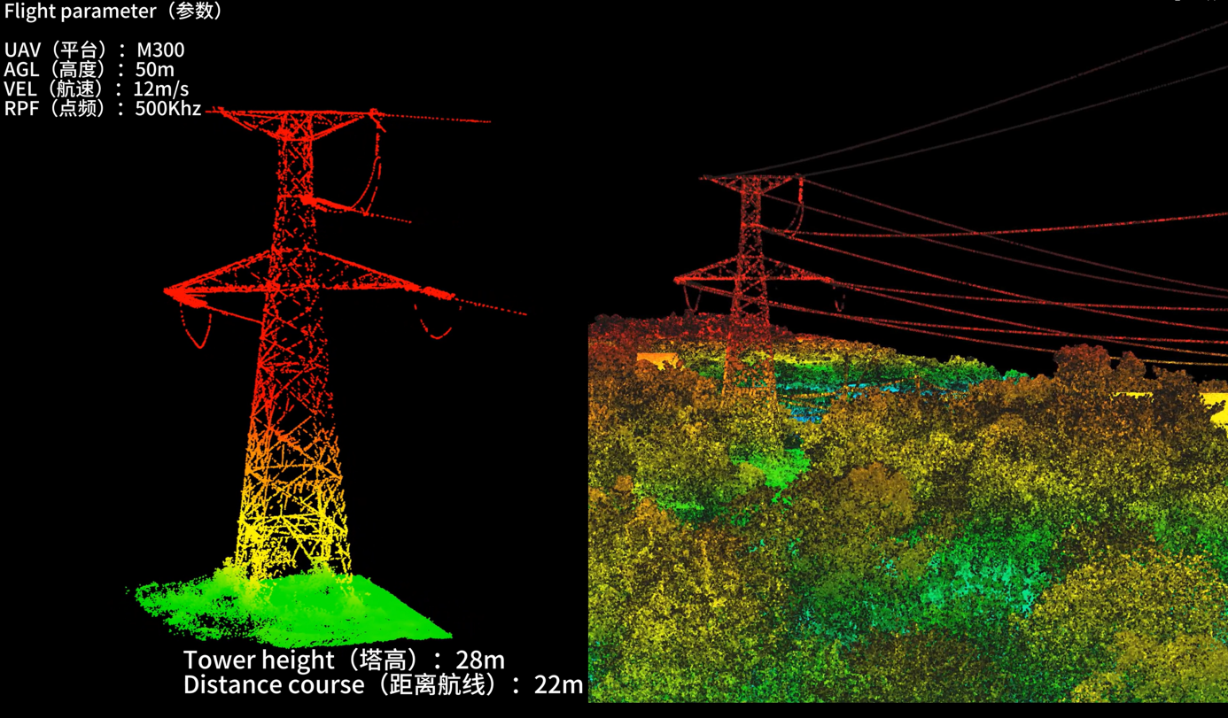
Power Tower (50m)
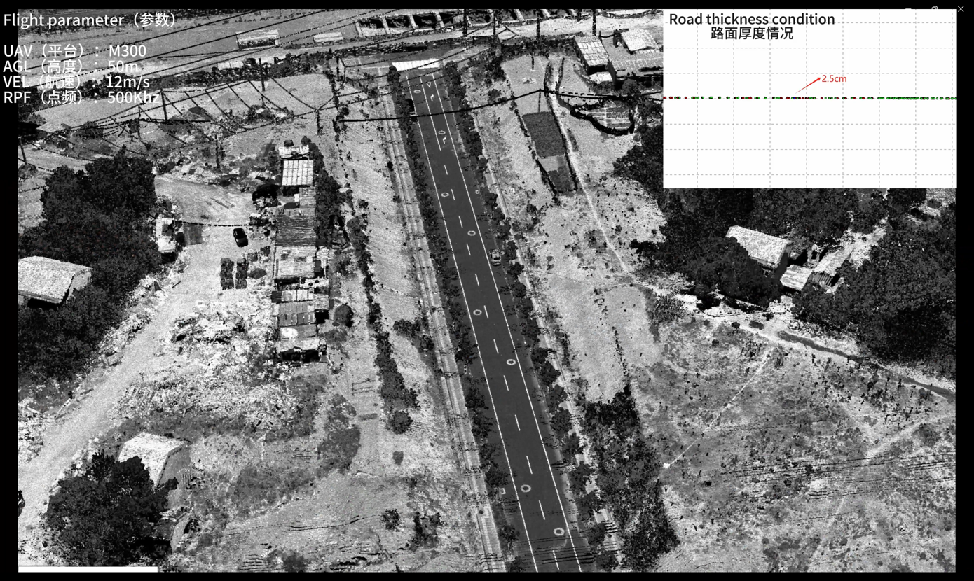
Road
Power Tower (50m)
Point cloud thickness: 2.5cm
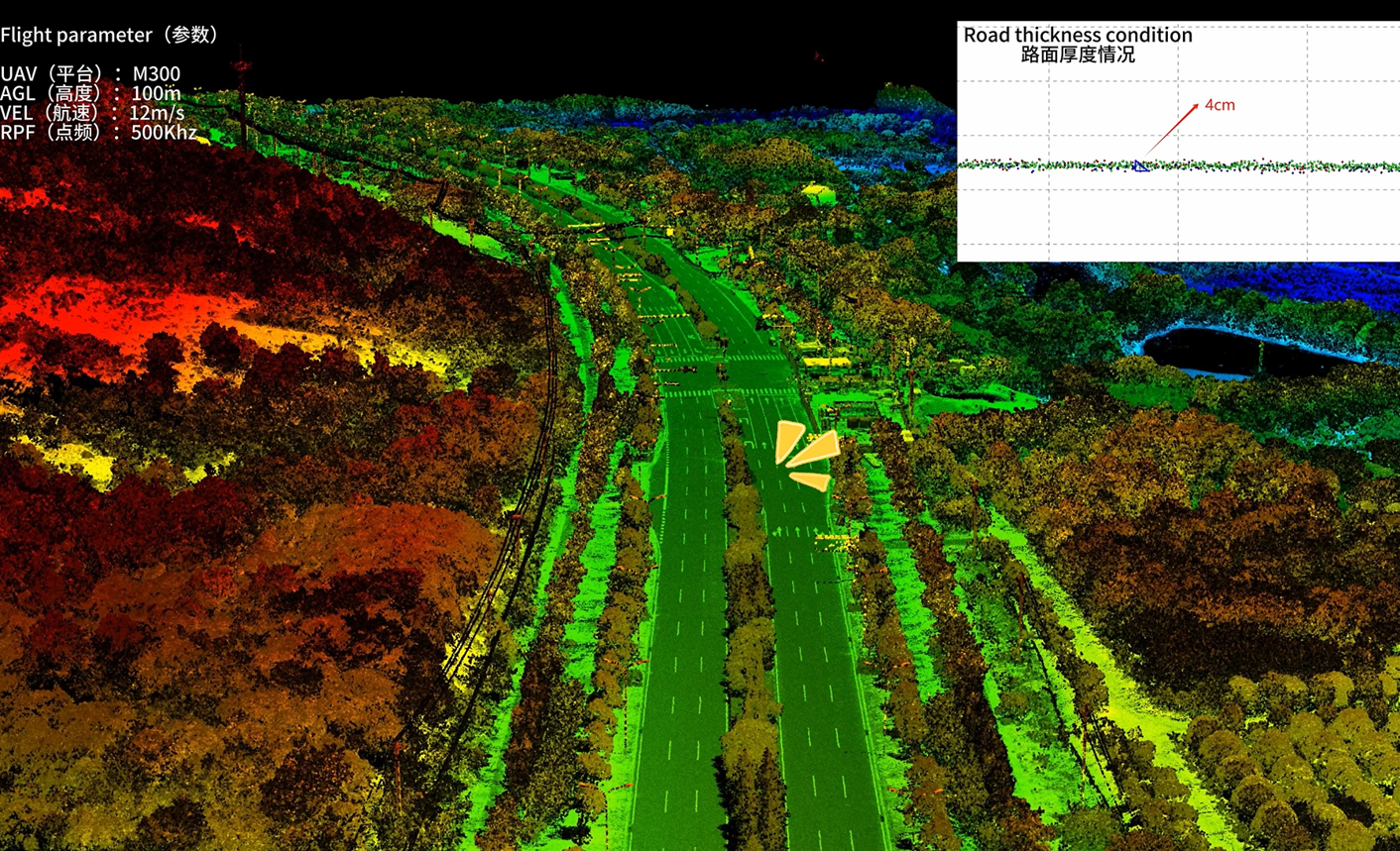
Road
Power Tower (100m)
Point cloud thickness: 4cm

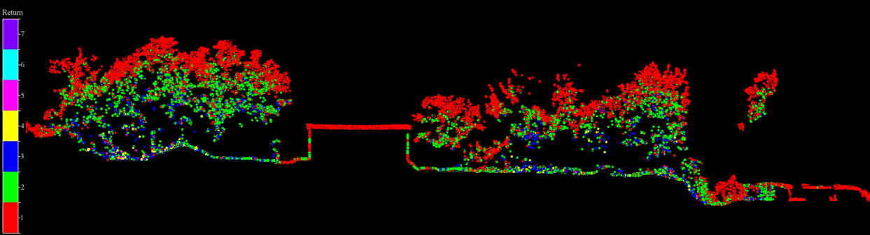
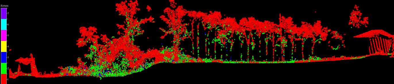
Small beam size for better penetration in vegetation
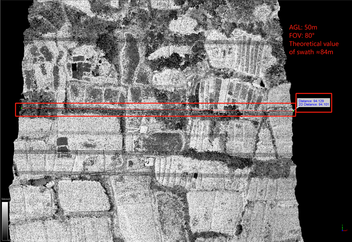
80° FoV to ensure 100% effective points
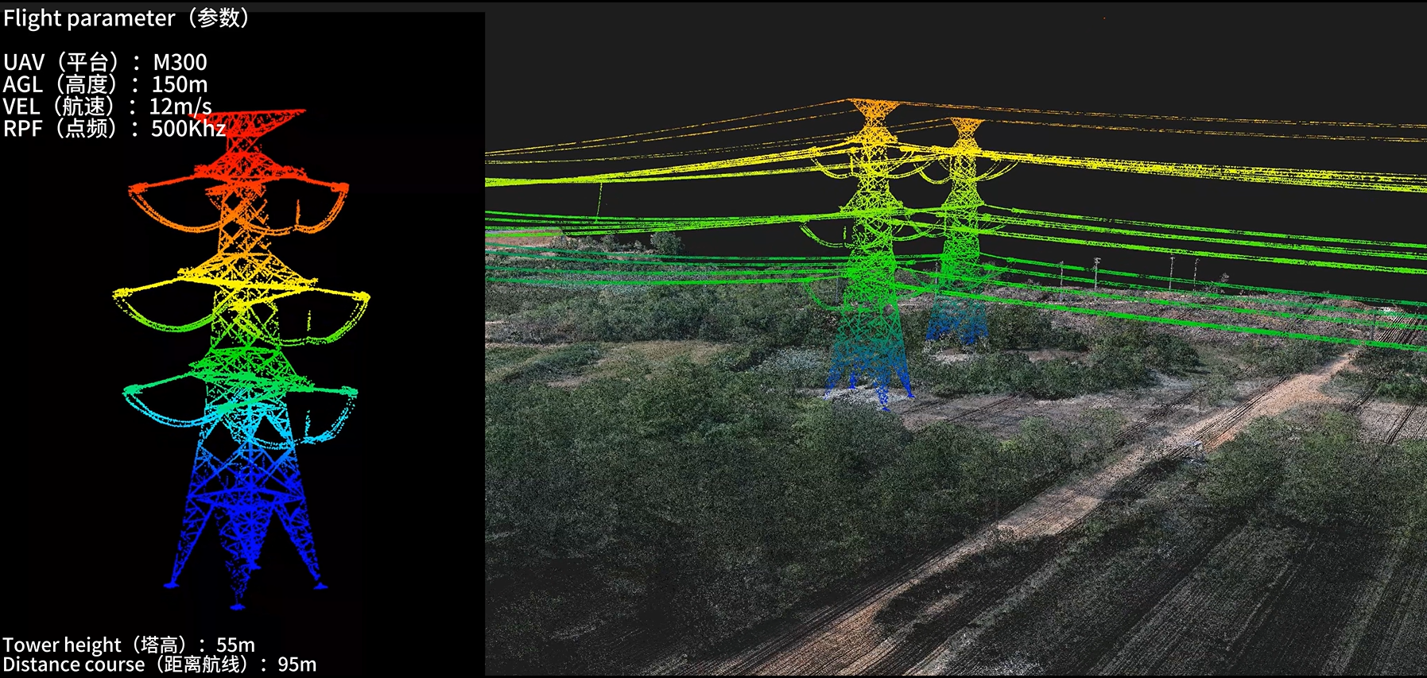
Power line
Tower height: 55m
Distance to the route: 95m